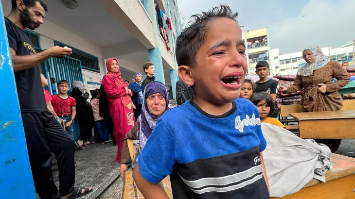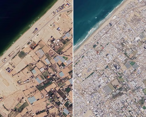
Gaza Herald- As Google Maps rolls out long-overdue satellite updates across the Gaza Strip, hundreds of thousands of displaced Palestinians are turning to digital screens in an agonizing search for what remains of their homes, neighborhoods, and memories. Far from mere cartographic updates, these high-resolution aerial images serve as incontrovertible visual evidence of the physical erasure of entire communities.
From Gaza City in the north to Khan Younis and Rafah in the south, the newly released imagery exposes a landscape transformed beyond recognition, where vibrant urban centers have been systematically pulverized into vast expanses of barren rubble and cratered wasteland.
Data compiled by the United Nations Satellite Centre (UNOSAT) in collaboration with news analysts reveals the true scope of this state-sanctioned devastation: approximately 82% of all structures across the Gaza Strip have been either destroyed or severely damaged.
This total includes over 90% of all civil infrastructure, shattering the electrical grids, water treatment networks, sanitation systems, schools, and medical centers essential for human survival. Even after the October 2025 ceasefire agreement, the human and physical toll has continued to climb, with total casualties since October 2023 reaching over 74,032 martyrs and 175,142 wounded, illustrating that the genocidal war has permanently altered both the demographic and physical reality of the enclave.
In southern Gaza, the satellite record traces the relentless cycle of forced displacement. Neighborhoods like Tel Al-Sultan in Rafah, once designated as safe zones for fleeing families, show near-total structural liquidation following successive Israeli military incursions.
Agricultural zones like Al-Mawasi have been subsumed by sprawling, densely packed tent cities, forcing refugees to endure severe winters without access to clean water or sanitation. In Khan Younis and surrounding areas, whole residential blocks and historic thoroughfares have simply ceased to exist, turning basic attempts by returnees to locate their family property into an impossible, traumatizing ordeal.
Ultimately, these satellite records capture far more than physical destruction; they document the deliberate dismantling of Palestinian social life and cultural memory. While rebuilding concrete structures presents an astronomical economic challenge, restoring the delicate social fabric, family histories, and community identity rooted in these erased neighborhoods will take generations.
The aerial view of Gaza serves as a permanent, digital indictment of a deliberate policy of territorial erasure, a reality where maps no longer guide people home, but rather archive the physical disappearance of the places they once lived.